Transcript
NARRATOR:
For seven days in the Fall of 2012, Hurricane Sandy pounded the Caribbean and US East Coast with punishing rain, wind, and waves. As the storm approached landfall, the National Hurricane Center renamed the hurricane "Post-Tropical Cyclone Sandy." But to those whose lives were devastated – it will always be remembered as super storm Sandy.
What happened in the atmosphere that caused this monstrous storm to form? Summer and winter weather conditions collided with extreme forces. The primary difference between a tropical cyclone, also called a hurricane, and a wintertime cyclone is the energy source. Tropical cyclones extract heat from the ocean and grow by releasing that heat in the atmosphere near the storm center. Wintertime storms, on the other hand, get most of their energy from temperature contrasts in the atmosphere, and this energy usually gets distributed over larger areas.
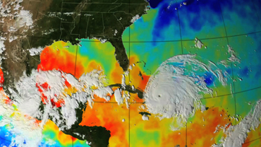
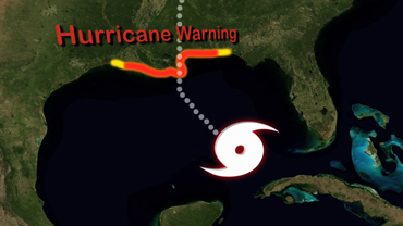
Sandy started out as a classic hurricane, getting energy from the warm waters of the Caribbean and moving northward along the Gulf Stream. Sandy then took a sharp left turn into the New Jersey and New York coasts and collided with a winter-like storm system.
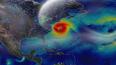
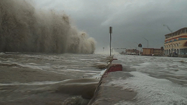
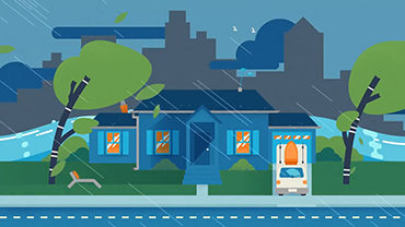
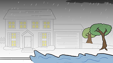
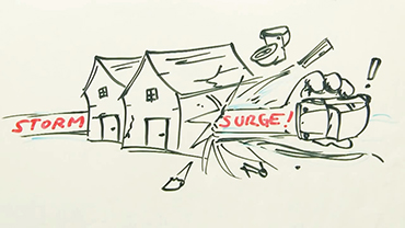
As Sandy’s energy source transitioned from the warm ocean water to the atmosphere it morphed into a wintertime cyclone and dramatically increased in size. High winds extended 1,000 miles across bringing record-breaking storm surges to coastal areas and blizzard conditions to the mountains. Tunnels turned into rivers and parking lots into ponds. Residents returned to find their belongings floating in pools of water in their homes and yards. Cars were pushed around like toys and mountains of sands filled the streets. Power outages lasted for days, weeks, and in some places for months. One neighborhood even burned to the ground.
Initial calculations for damages were $50 billion. As cities and towns rebuild that number continues to rise. Sandy is a heartbreaking reminder that the end of summer isn’t the end of hurricane season. Hurricane season runs from June 1 to November 30 with the peak of the season from mid-August to late October. Put together an emergency plan and supply kit now, so you are prepared for extreme weather no matter when it strikes.
Transcripción
La Formación de una Súper Tormenta
Por siete días en el otoño del 2012, el huracán Sandy castigó el Caribe y la Costa Este de los Estados Unidos con fuertes lluvias, vientos y olas. Mientras la tormenta se aproximaba a tocar tierra, el centro nacional de huracanes le cambio de nombre a “Ciclón Post-Tropical Sandy”. Pero para aquellos que sus vidas quedaron devastadas la recordaran siempre como Sandy “La Súper Tormenta”.
¿Qué fue lo que pasó en la atmósfera que causó que esta tormenta monstruosa se formara? Las condiciones climáticas del verano y el invierno chocaron con una fuerza extrema. La primera diferencia entre un ciclón tropical, también llamado huracán, y un ciclón de invierno es la fuente de energía. Los ciclones tropicales extraen el calor del océano y crecen liberando ese calor en la atmósfera cerca del centro de la tormenta. Las tormentas de invierno, por otro lado, obtienen la mayoría de su energía por el contraste de temperaturas en la atmósfera, y esta energía es distribuida sobre grandes áreas.
Sandy empezó como un huracán normal. Obteniendo energía de las aguas cálidas del Caribe y moviéndose al norte con la Corriente del Golfo. Sandy después tomó un giro inesperado a la izquierda adentrándose a las costas de Nueva Jersey y Nueva York colisionando con un sistema de tormenta invernal.
Mientras la fuente de energía de Sandy hizo transición de las cálidas aguas oceánicas a la atmósfera, se transformó en un ciclón invernal y aumentó su tamaño dramáticamente. Fuertes vientos se extendieron hasta 1,600 kilómetros, dejando tormentas de marea en las áreas costeras y fuertes ventiscas en las montañas que rompieron récords. Los túneles se convirtieron en ríos y los estacionamientos en lagos. Los residentes regresaron para encontrar sus pertenencias flotando en las albercas que se formaron en sus casas y patios. Los coches fueron empujados como si fueran juguetes y montañas de arena llenaron las calles. Los cortes eléctricos duraron por días, semanas y en algunos lugares hasta meses. Incluso un sector completo de casas se destruyó por completo.
Los cálculos iniciales de los daños fueron de 50 mil millones de dólares. Mientras las ciudades y los pueblos se reconstruían, ese número seguía subiendo. Sandy es un triste recordatorio de que el final del verano no es el final de la temporada de huracanes. La temporada de huracanes es del 1ro. de junio al 30 de noviembre, con el pico de la temporada de mediados de agosto a finales de octubre. Implementa estrategias de emergencia y kits de supervivencia ahora, para que estés preparado contra el clima extremo sin importar cuando se presente.
 An official website of the United States government.
Here's how you know we're official.
An official website of the United States government.
Here's how you know we're official.